Hydrography of Mesopotamia:
Assyria and Babylonia
Sebastian Borkowski M.A.
Prof. Dr. Mirko Novák
Dr. Susanne Rutishauser
Dr. Eveline C. Zbinden
Prof. Dr. Andreas Zischg
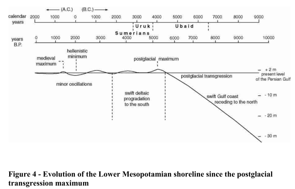
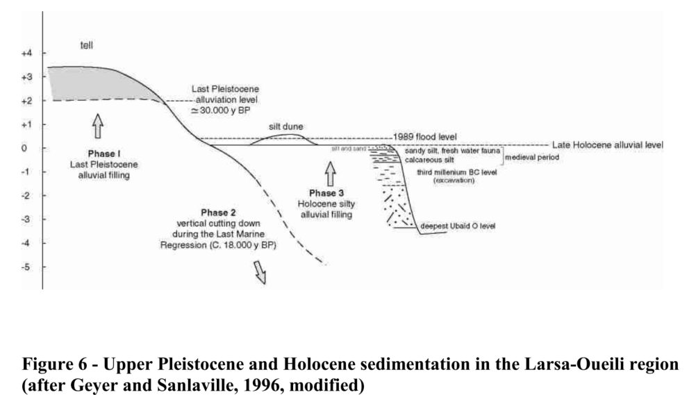
Sanlaville (2002)
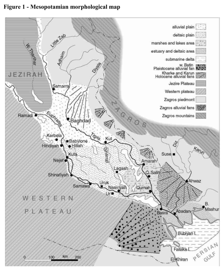
Sanlaville, P. (2002): The Deltaic Complex of the Lower Mesopotamian Plain and its Evolution through Millennia, in: Clark, P./Nicholson, E. (ed.), The Iraqi Marshlands. A Human and Environmental Study, London, 94–109, Fig. 1.
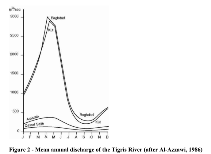
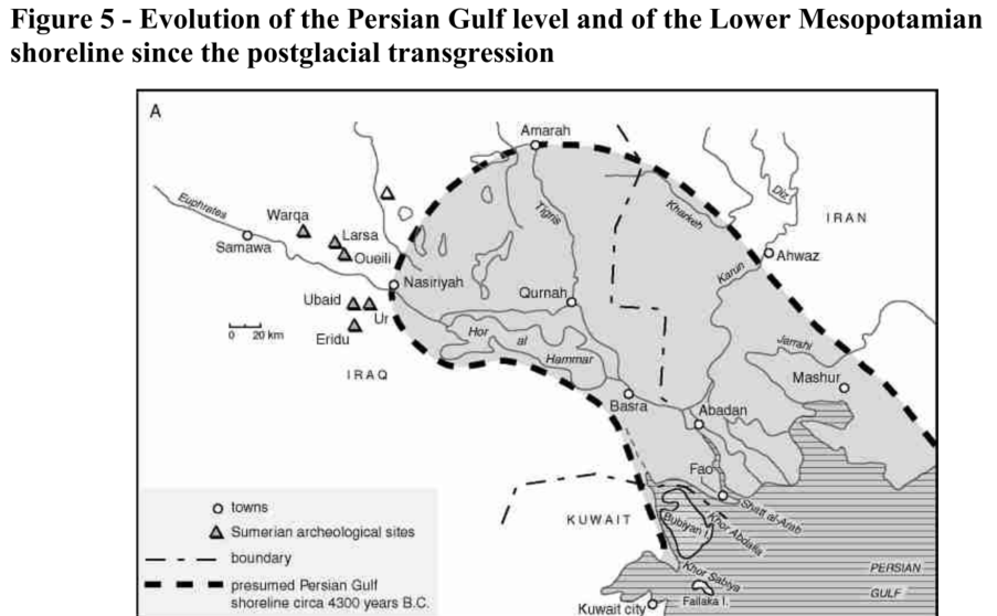
Sanlaville (2002)
Sanlaville, P. (2002): The Deltaic Complex of the Lower Mesopotamian Plain and its Evolution through Millennia, in: Clark, P./Nicholson, E. (ed.), The Iraqi Marshlands. A Human and Environmental Study, London, 94–109, Fig. 2.
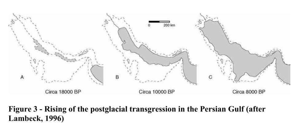
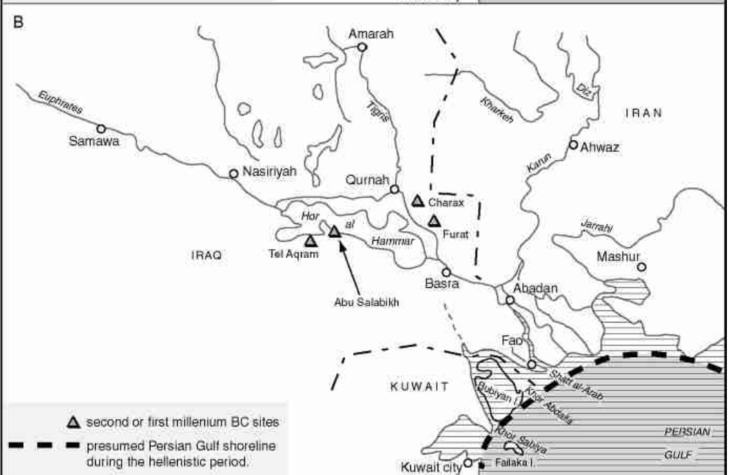
Sanlaville (2002)
Sanlaville, P. (2002): The Deltaic Complex of the Lower Mesopotamian Plain and its Evolution through Millennia, in: Clark, P./Nicholson, E. (ed.), The Iraqi Marshlands. A Human and Environmental Study, London, 94–109, Fig. 3.
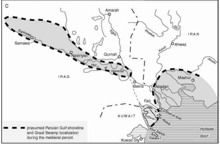
Sanlaville (2002)
Sanlaville, P. (2002): The Deltaic Complex of the Lower Mesopotamian Plain and its Evolution through Millennia, in: Clark, P./Nicholson, E. (ed.), The Iraqi Marshlands. A Human and Environmental Study, London, 94–109, Fig. 4.
Sanlaville (2002)
Sanlaville, P. (2002): The Deltaic Complex of the Lower Mesopotamian Plain and its Evolution through Millennia, in: Clark, P./Nicholson, E. (ed.), The Iraqi Marshlands. A Human and Environmental Study, London, 94–109, Fig. 5.
Sanlaville (2002)
Sanlaville, P. (2002): The Deltaic Complex of the Lower Mesopotamian Plain and its Evolution through Millennia, in: Clark, P./Nicholson, E. (ed.), The Iraqi Marshlands. A Human and Environmental Study, London, 94–109, Fig. 6.
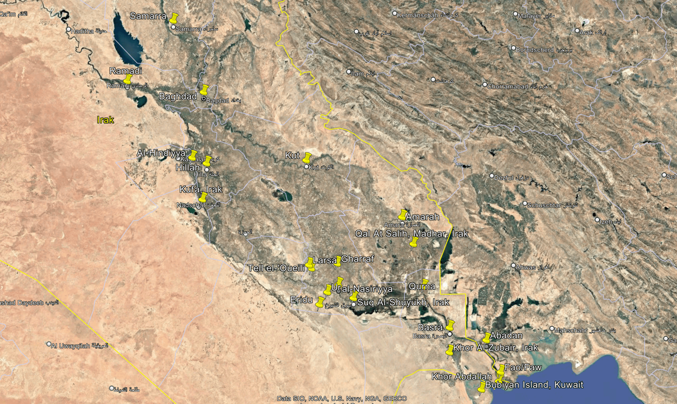
Placemarks (Ilias)
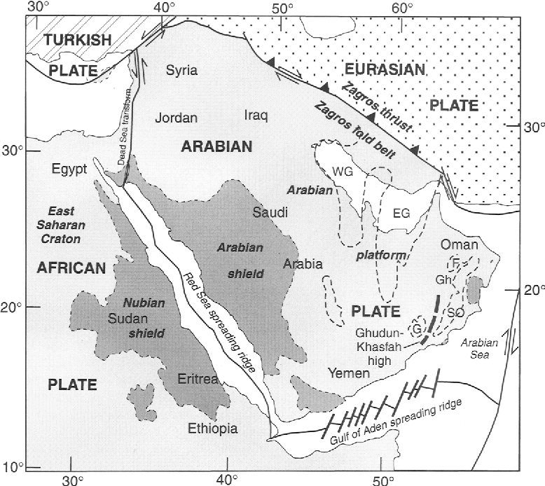
Arabian Shield
Fig 1. Present-day tectonic setting of Precambrian rocks exposed on either side of the Red Sea and in Oman, and Precambrian deposition basins in the subsurface (dashed outline). EG, Eastern Gulf Basin; F, Fahud Basin; G, Ghudun Basin; Gh, Ghaba Basin; SO, South Ornan Basin; WG, Western Gulf Basin
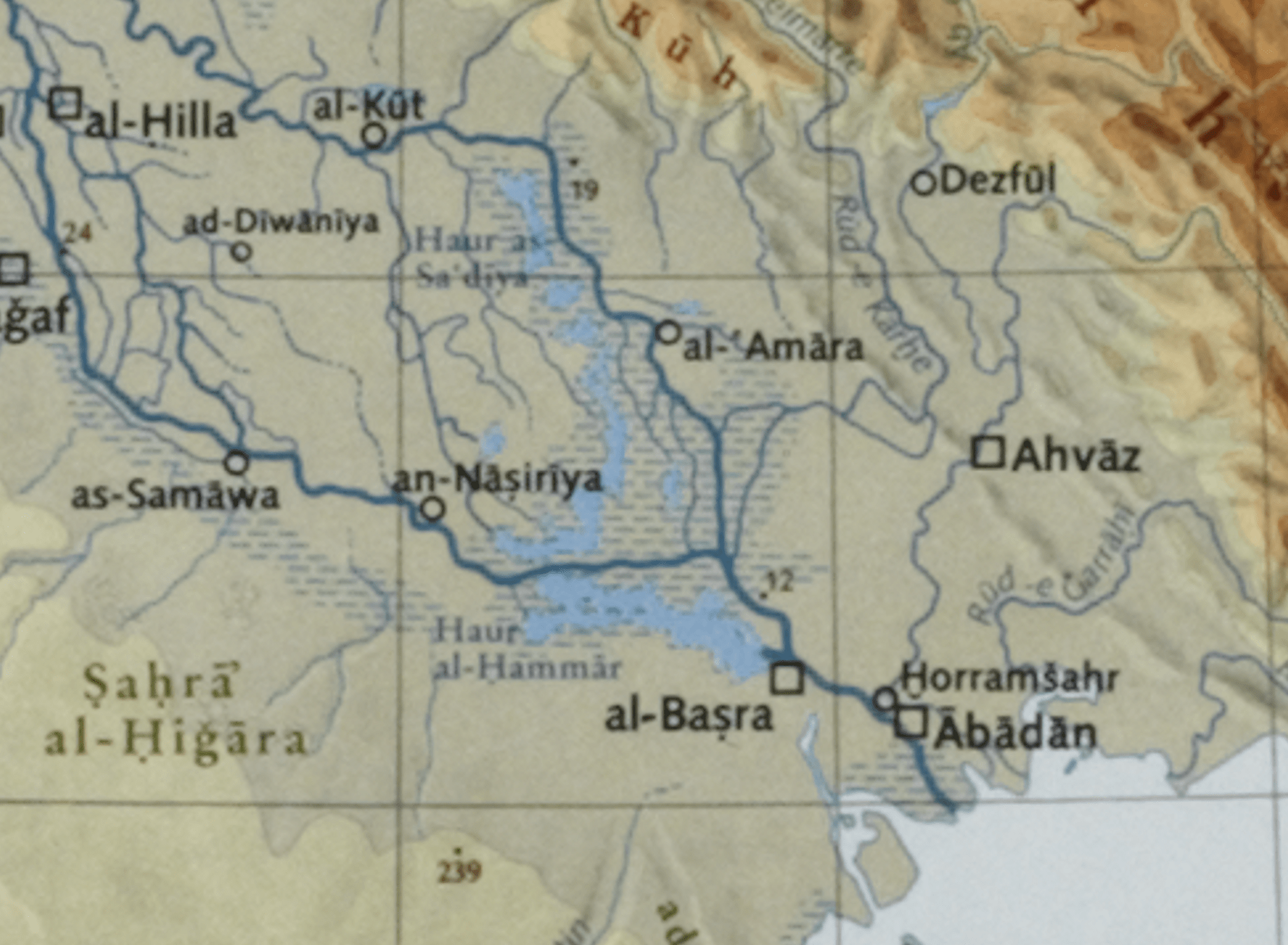
Rivers, Wadis
Kārūn river
Karkheh river
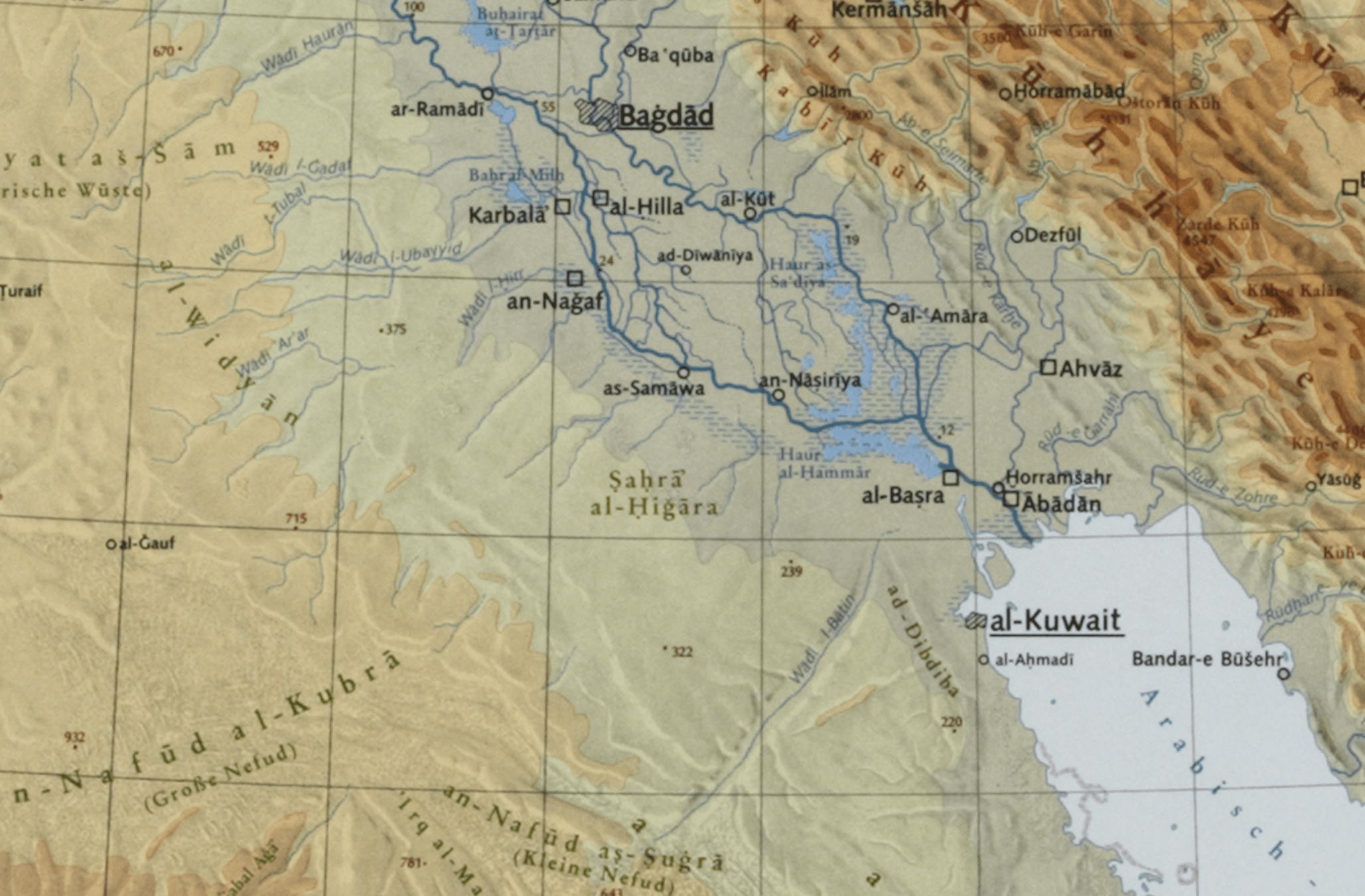
Wadi Batin
Rivers
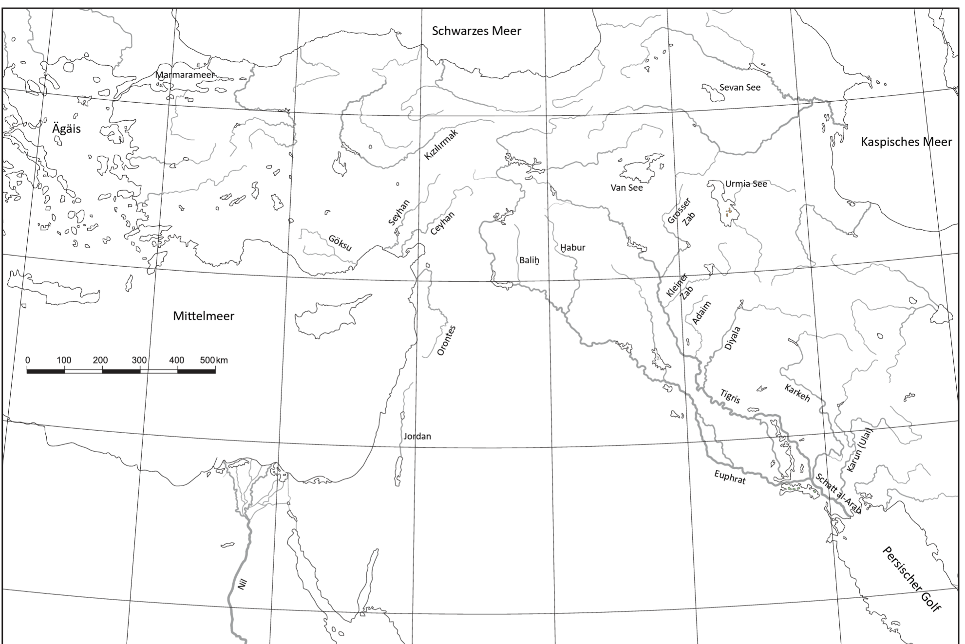
Khabur
Deserts
Nafud
Rub al Khali
Mountains
Taurus
Zagros
Tectonic Map of Iraq
Jassim, S.Z. and Buday, T., 2006. Tectonic Framework. In Jassim, S.Z. and Goff, J.C. (Eds.), Geology of Iraq. Dolin, Prague and Moravian Museum, Brno, Czech, PP. 45-55.
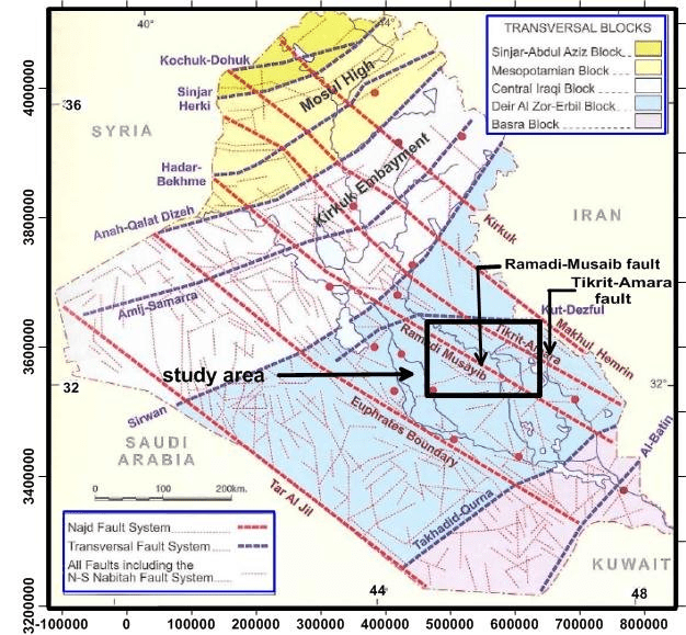
Takhadid-Qurna transversal fault
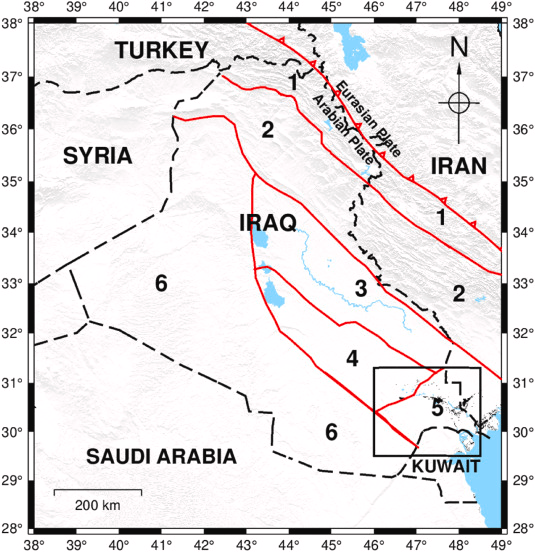
Tectonic Divsions of Iraq
Muntadher Al-Kaabi, Dania Hantoosh, Baraa Neamah, Hajir Almohy, Zahraa Bahlee, Maher Mahdi, Wathiq Abdulnaby, Classification of the Zubair Subzone oilfields using structural contour maps, Southern Iraq, Journal of African Earth Sciences, Volume 197, 2023.
Fig. 1. Tectonic division of Iraq and the subdivision of the Mesopotamian zone according to Buday and Jassim (1987) and Jassim and Göff (2006). The black square represents the study area. The black dashed line is the border of countries. 1 Zagros Thrust (Thrust, Imbricated, and High Floded Zones). 2 Simply Folded Belt (Low Folded Zone). 3 Tigris Subzone. 4 Euphrates Subzone. 5 Zubair Subzone. 6 Inner Arabian Platform.
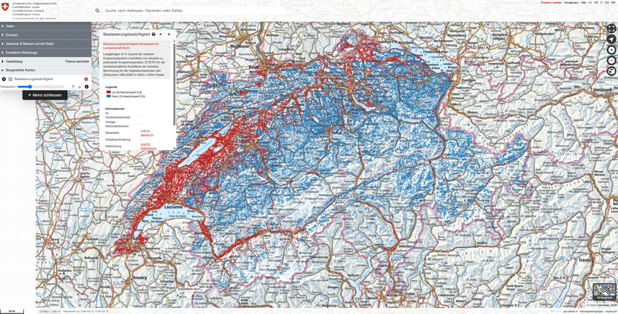
Relative Evapotranspiration
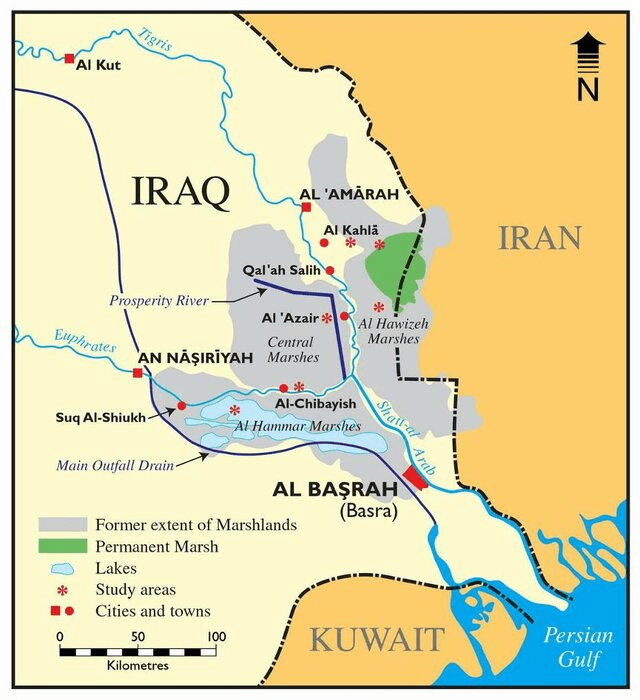
Marshes
Hydrography 05
By zastrugis


