Hydrography of Mesopotamia
Assyria and Babylonia
Sebastian Borkowski M.A.
Prof. Dr. Mirko Novák
Dr. Susanne Rutishauser
Dr. Eveline C. Zbinden
Prof. Dr. Andreas Zischg
Round of Introduction
Administration
Intro Archaeology
Presentation Topic

Round of Introduction: lecturers
- Mirko Novák
- Andreas Zischg
- Sebastian Borkowski
- Susanne Rutishauser
- Eveline C. Zbinden
Round of Introduction: students
Ilias: short survey about your knowledge level and language skills

- Please write a name tag
Administration
- Tuesday, 14.15–15.45 (UniS, S101)
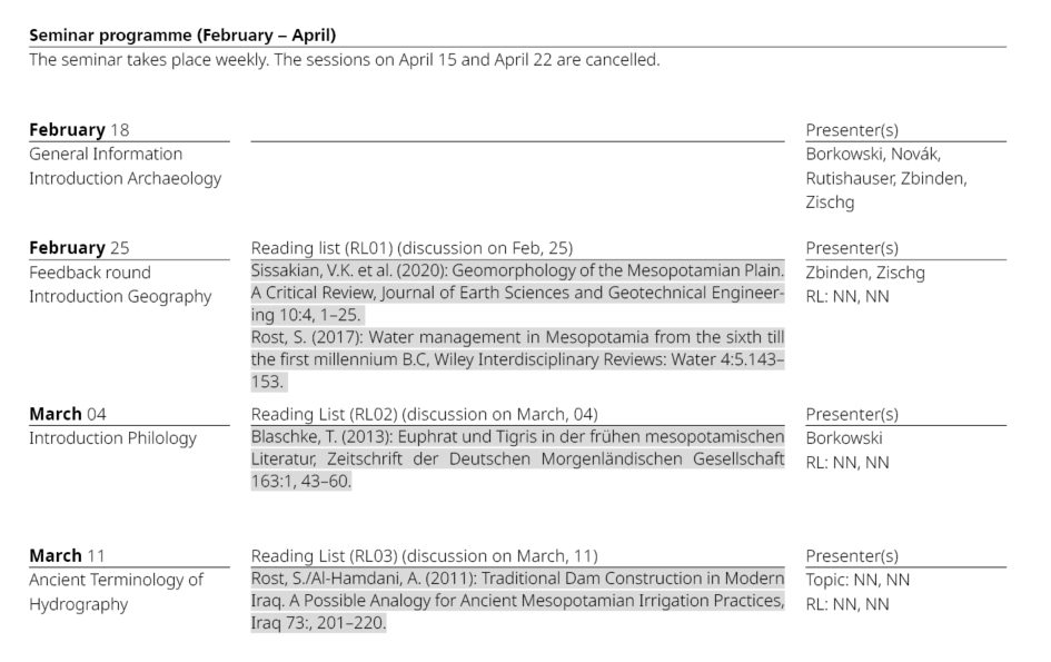
- The seminar takes place weekly. The sessions on April 15 and April 22 are cancelled.
-
ECTS: 6 (= 150–180 working hours)
- attendance 20 hours
- weekly preparation of texts from the reading list (individual)
- once: preparation of a discussion (teamwork)
- once: presentation and handout (teamwork)
- seminar paper (individual)
Ilias
- tbd
- tbd
- tbd
Questions about Ilias:
Procedure
Procedure

Expectations
Expectations I
Attendance
- Regular attendance is expected. Two absences are allowed with prior notification.
- if you are unable to attend, please let us know as early as possible: sebastian.borkowski@unibe.ch
Expectations II
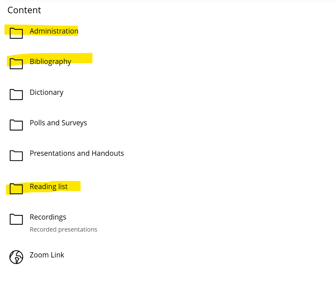
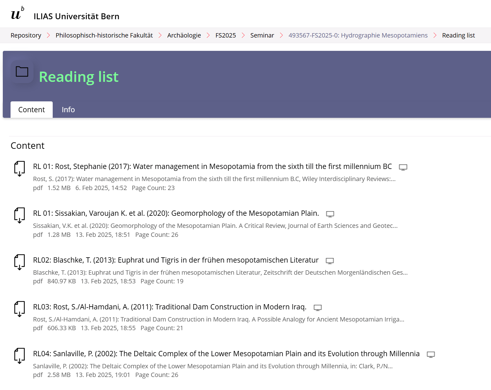
Reading list
- Individual, weekly preparation of texts from the reading list is expected.
- The papers are on Ilias in the "Reading list" folder.
Expectations III
Discussion
- One-time, prepare a discussion (15 min) of a scientific text from the reading list in a group by summarising its focal points, methods, and results and relating the texts to the topic of the respective session.
- This counts for 10% of the final grade (group assessment).
Expectations IV
Presentation and Handout
- Prepare and give an interdisciplinary presentation (40 min) on a topic in a group, including a handout (2000–5000 characters with spaces and bibliography).
- A draft of the handout must be submitted to all lecturers one week before the presentation.
- The final version of the handout must be uploaded to Ilias into the folder "handout" until Sunday evening before the presentation, a PDF (and pptx) of the presentation on the day of the presentation.
- Handout and presentation count for 40% of the final grade (group assessment).
Expectations V
Seminar paper
- Individual writing of a seminar paper (9000–12000 characters including spaces and bibliography) on a specific topic not directly related to the presentation.
- own topic suggestions are welcome!
- This counts for 50% of the final grade.
- The paper may be written in either German or English.
-
Deadlines:
- Determining the topic: April 30
- Submission: July 31

Tutorium
The seminar will be accompanied by a voluntary Tutorium led by Andrea Kohli (andrea.kohli@students.unibe.ch).
Andrea Kohli: andrea.kohli@students.unibe.ch
Archaeology: Susanne Rutishauser
Geography: Eveline C. Zbinden
Philology: Sebastian Borkowski
Archaeolgy
Historical overview
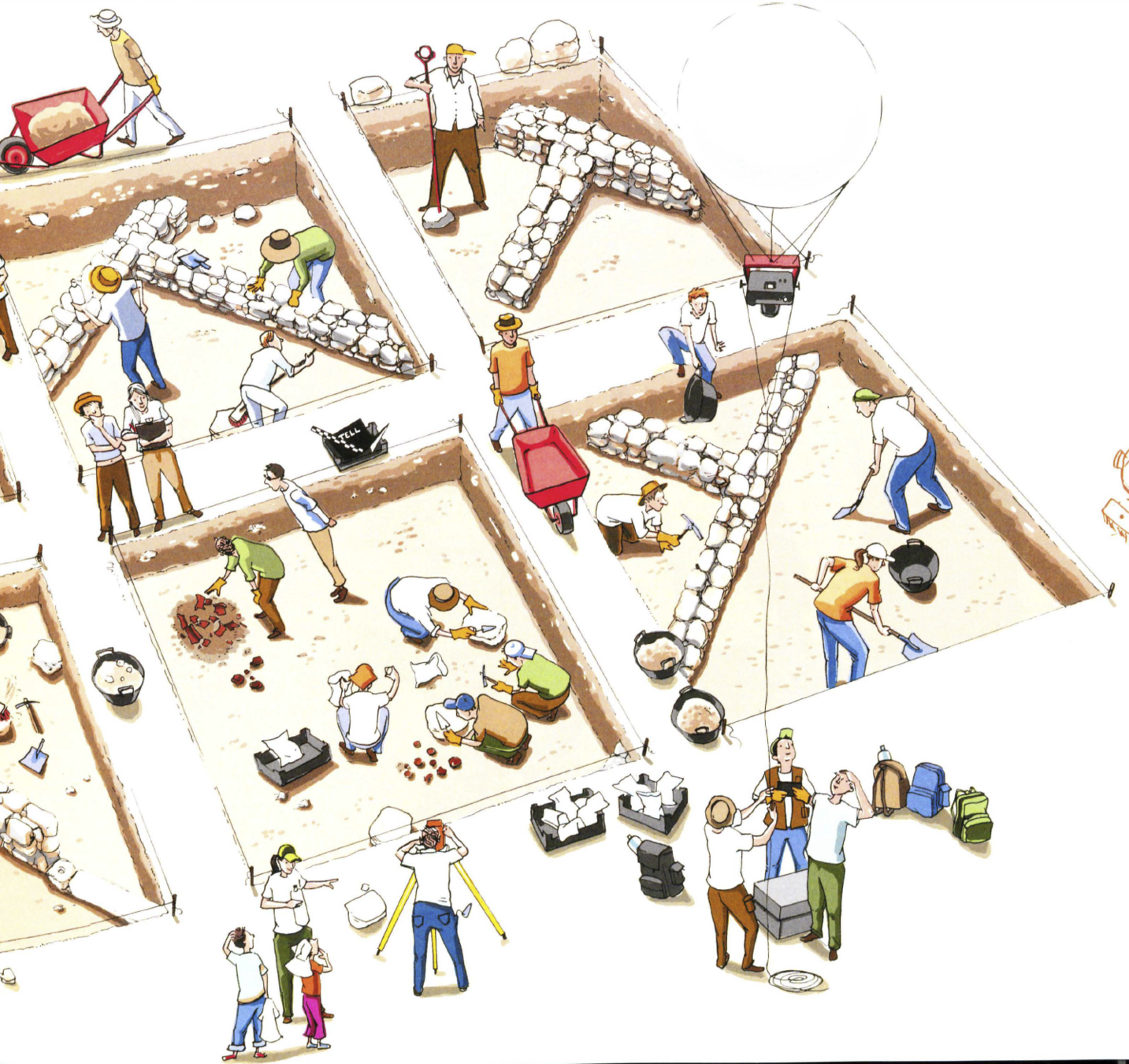
Excavation
Prospection
Iconography
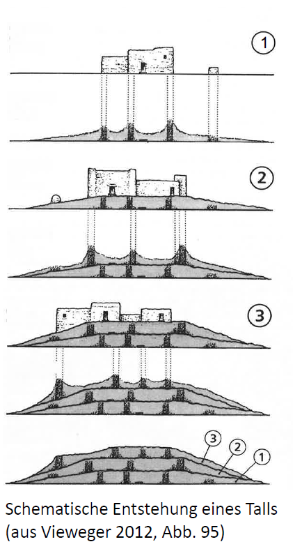
Tell site
- arab. tall/tell „Hügel“, „Anhöhe“
- türk. höyük
- pers. tappe/tepe
- akk. tillu(m) „Schutthügel“
Vieweger, Dieter (2012): Archäologie der biblischen Welt. Gütersloh: Gütersloher Verlagshaus, Abb. 95.
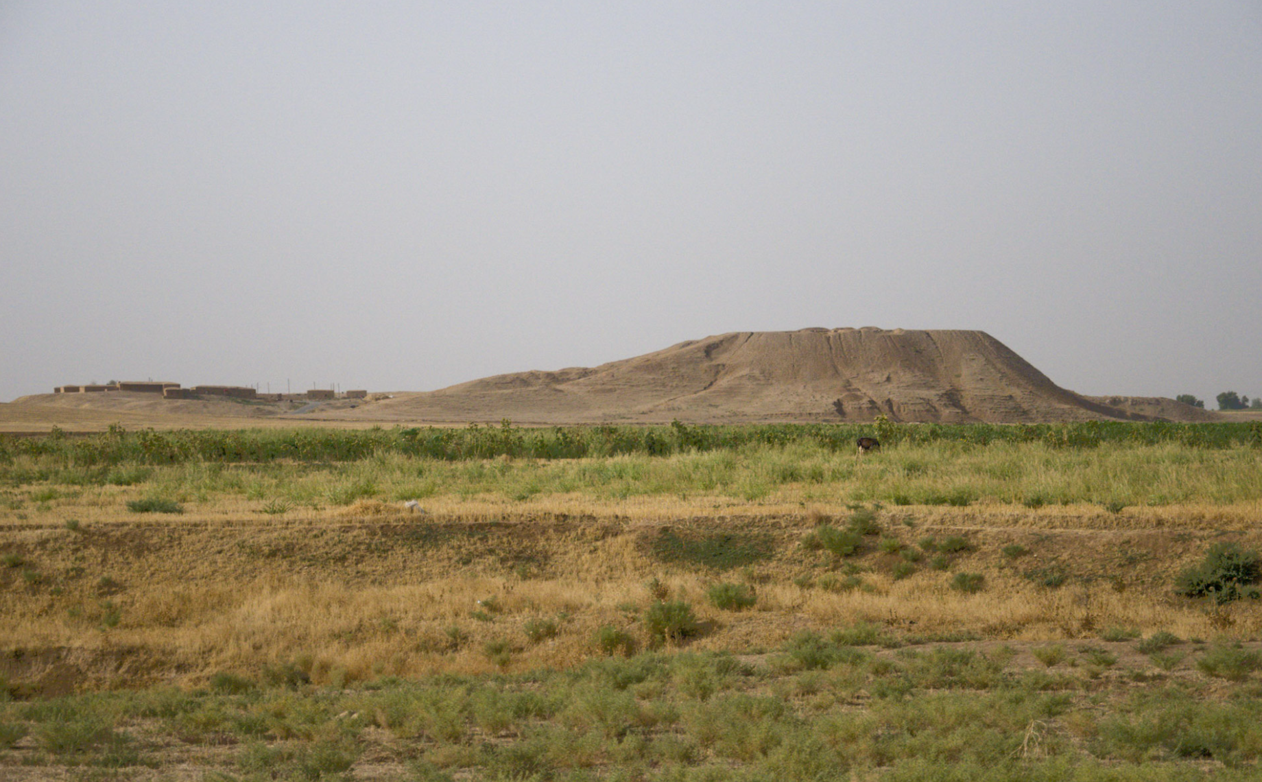
Tall al-Ḥamīdīya, Syrien (2010, Rutishauser)
Excavation
Vieweger, D. (2011): Das Geheimnis des Tells. Arachne, S. 23.
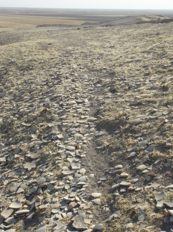
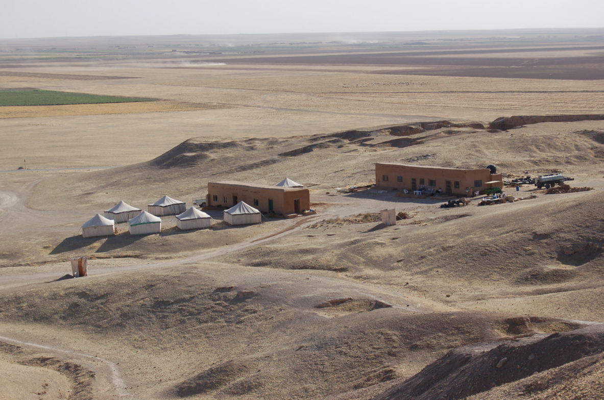
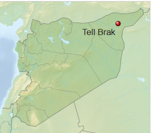
Tell Brak (Syria)
Tell Brak 2006 und 2010 (Susanne Rutishauser)
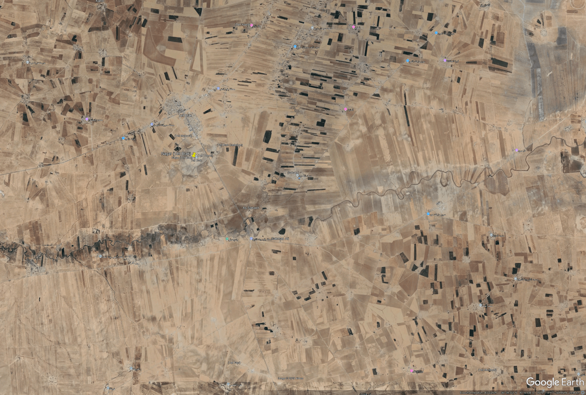
Large sites: Tell Brak vs Bern
Google Earth
- tbd
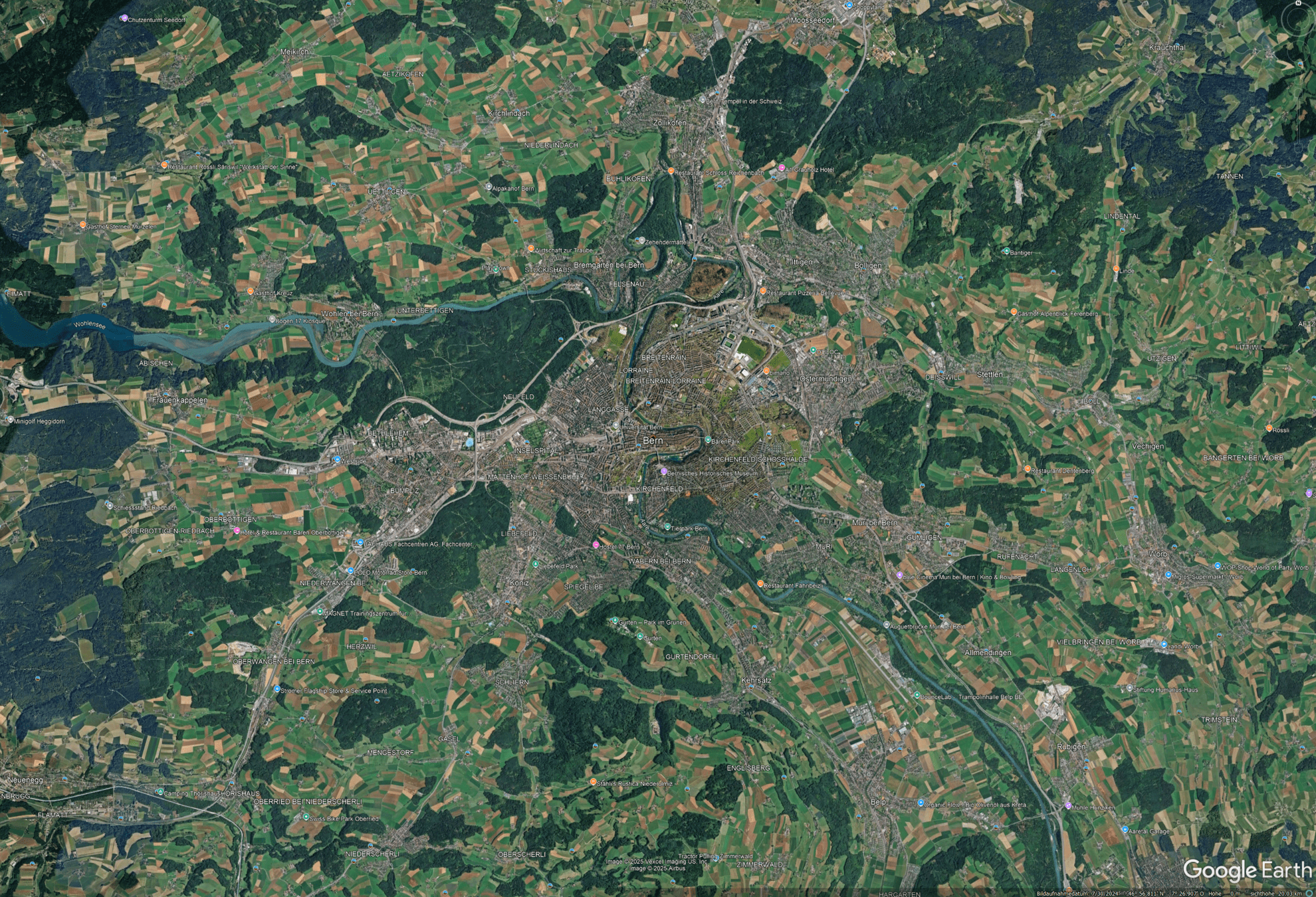
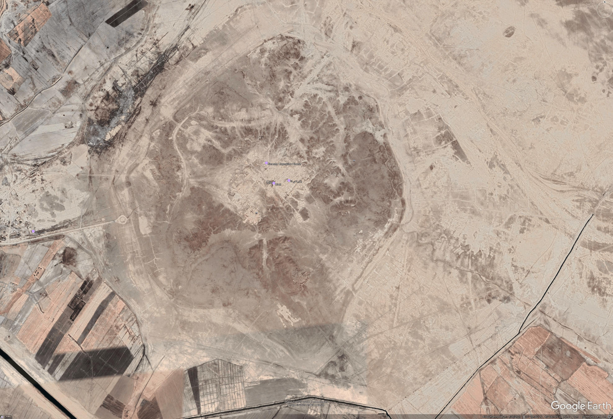
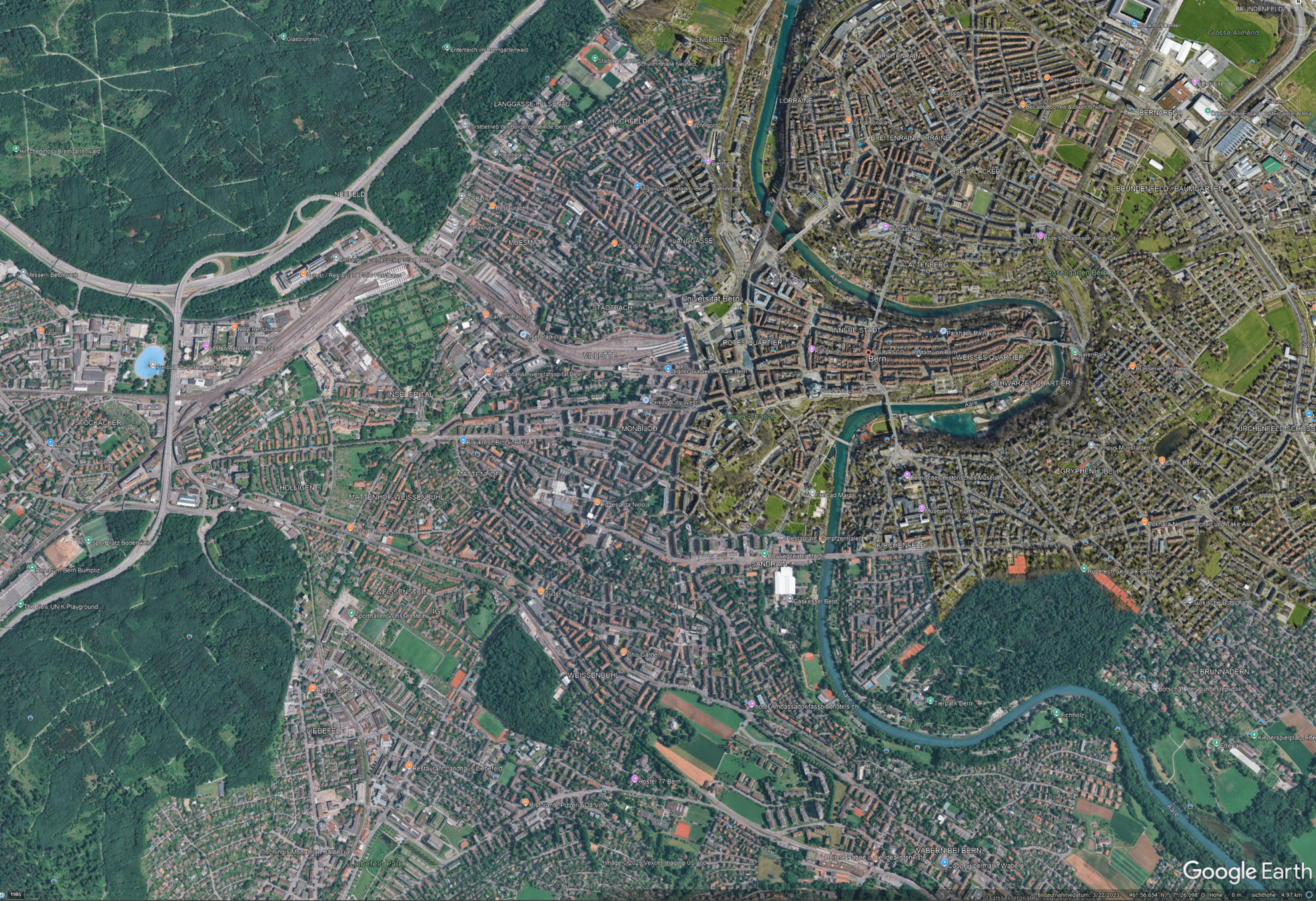
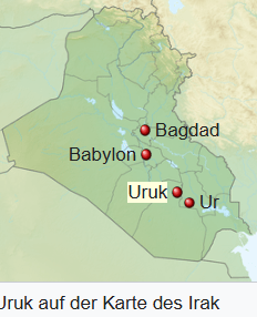
Large sites: Uruk vs Bern
Google Earth
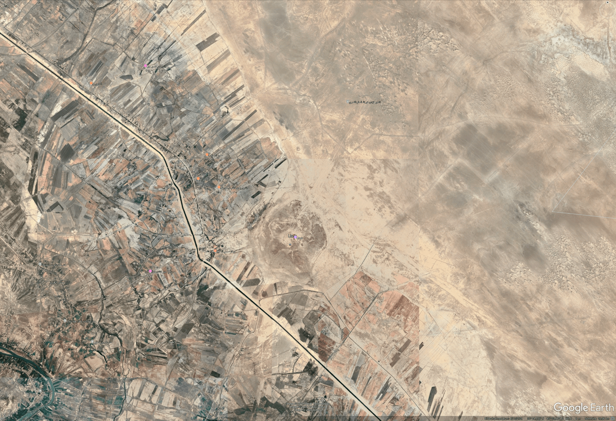
Large sites: Uruk vs Bern
Google Earth
Prospection methods
Travel reports
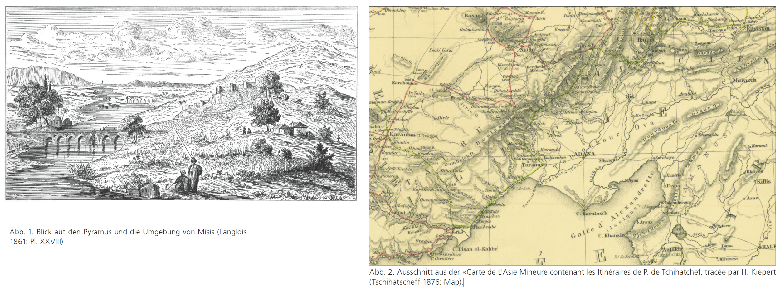
Abb. 1. Blick auf den Pyramus und die Umgebung von Misis (Langlois 1861: Pl. XXVIII)
Abb. 2. Ausschnitt aus der «Carte de L'Asie Mineure contenant les Itinéraires de P. de Tchihatchef, tracée par H. Kiepert (Tschihatscheff 1876: Map).
Travel reports
„After passing over the summit of Mount Taurus,which towards the east rises up to a vast height, Cilicia spreads itself out for a very great distance - a land rich in all valuable productions. It is bordered on its right by Isauria, which is equally fertile in vines and in many kinds of grain. The Calycadnus, a navigable river, flows through the middle of Isaurus.“
röm. Historiker Ammianus Marcellinus (um 330–395) hat als Soldat unter Constantinus II. und Julian gedient
„Wir fanden in diesen Gegenden Hormeniens solche Wälder, so frische Gewässer und so reine Luft, dass wir sehr lebhaft an Deutschland erinnert wurden“.
Wilbrand von Oldenburg (1211–1212), deutscher Geistlicher
Topography
- historical topography
- surveying
- photograpmmetry
Ralph Rosenbauer (2007)
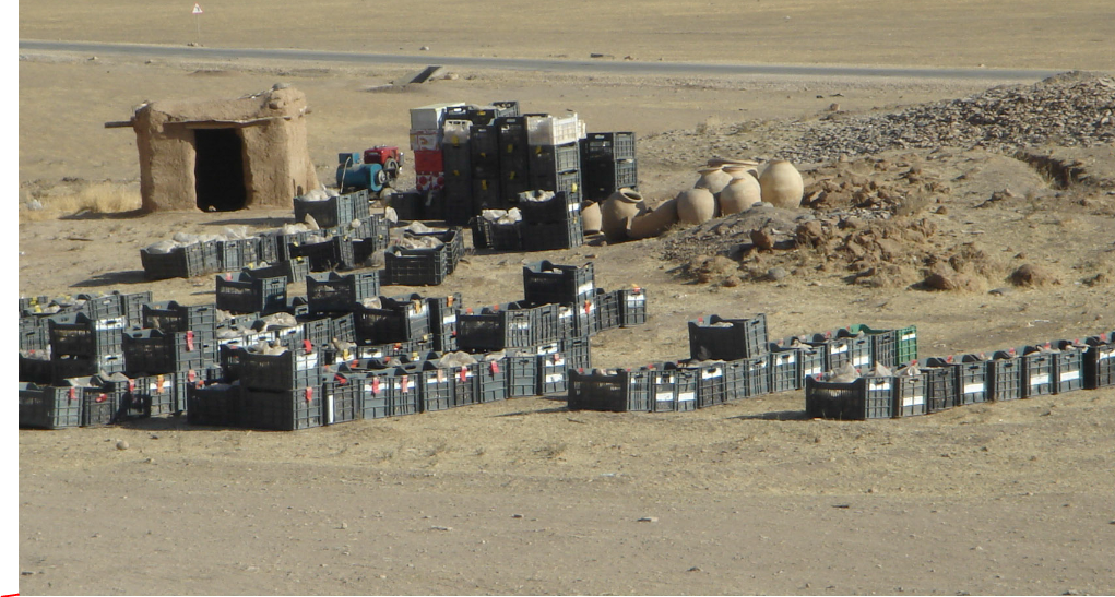
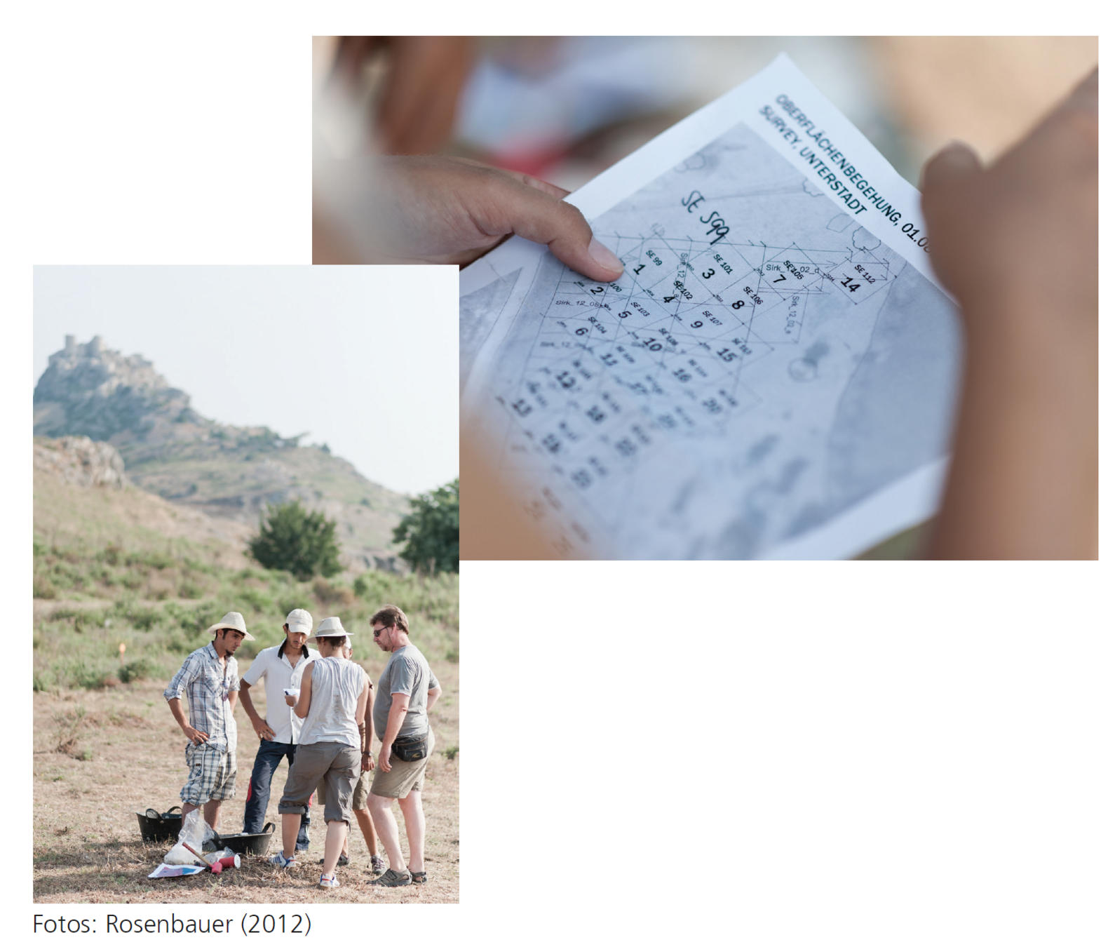
Classical prospection methods
- Survey (Flurbegehung)
- Coring / Sondage
Fotos: Ralph Rosenbauer (2012)
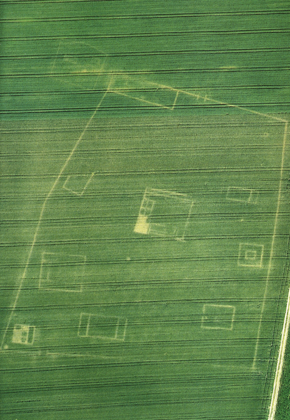
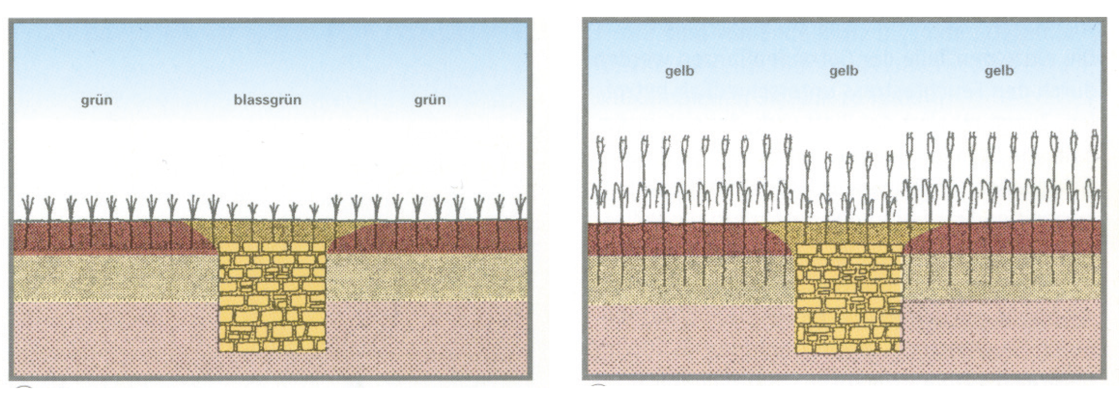
Remote sensing (Fernerkundung)
- Bewuchsmerkmale (crop marks)
- Bodenmerkmale (soil marks)
- Schattenmerkmale (engl. shadow marks)
Plan des römischen Gutshofes von Brenz (Baden-Württemberg)
Dillingen a.d. Donau, Bayern Grabhügelfeld
Braasch, Otto (2005): Vom heiteren Himmel… Luftbildarchäologie. Esslingen, 23, 30, 31.
Remote Sensing
Woolley, Charles Leonard (1956): Digging up the past. An introduction to archaeology showing how excavation has grown from a treasure hunt to a science. [Repr.]. Harmondsworth: Penguin (Pelican Books, A4), 28f.
«At Wadi Halfa, in the northern Sudan, MacIver and I had dug a temple and part of the Egyptian town, but, search the desert as we might for two months, we had failed to find any trace of the cemetery which must have been attached to the place. One evening we climbed a little hill behind the house to watch the sunset over the Nile; we were grumbling at our ill luck when suddenly MacIver pointed to the plain at our feet; its whole surface was dotted with dark circles which, though we had tramped over it day after day, we had never seen. I ran down the hill and the circles vanished as I came close to them but, guided by MacIver from above, I made little piles of gravel here and there, one in the middle of each ring; and when we started digging there next morning our Arab workmen found under each pile the square, rock-cut shaft of a tomb.»
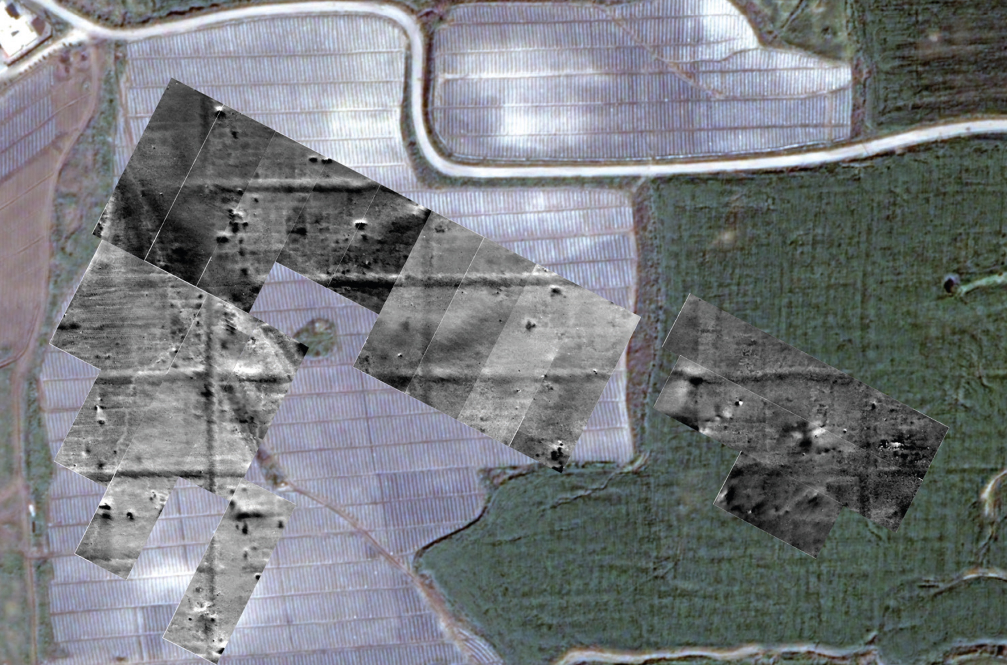
Historic satellite imagery

Geophysical & Chemical prospection
- Geoeletric
- Geomagnetic
- Georadar
- Seismik
- Electromagnetic induction
- Phosphate analysis
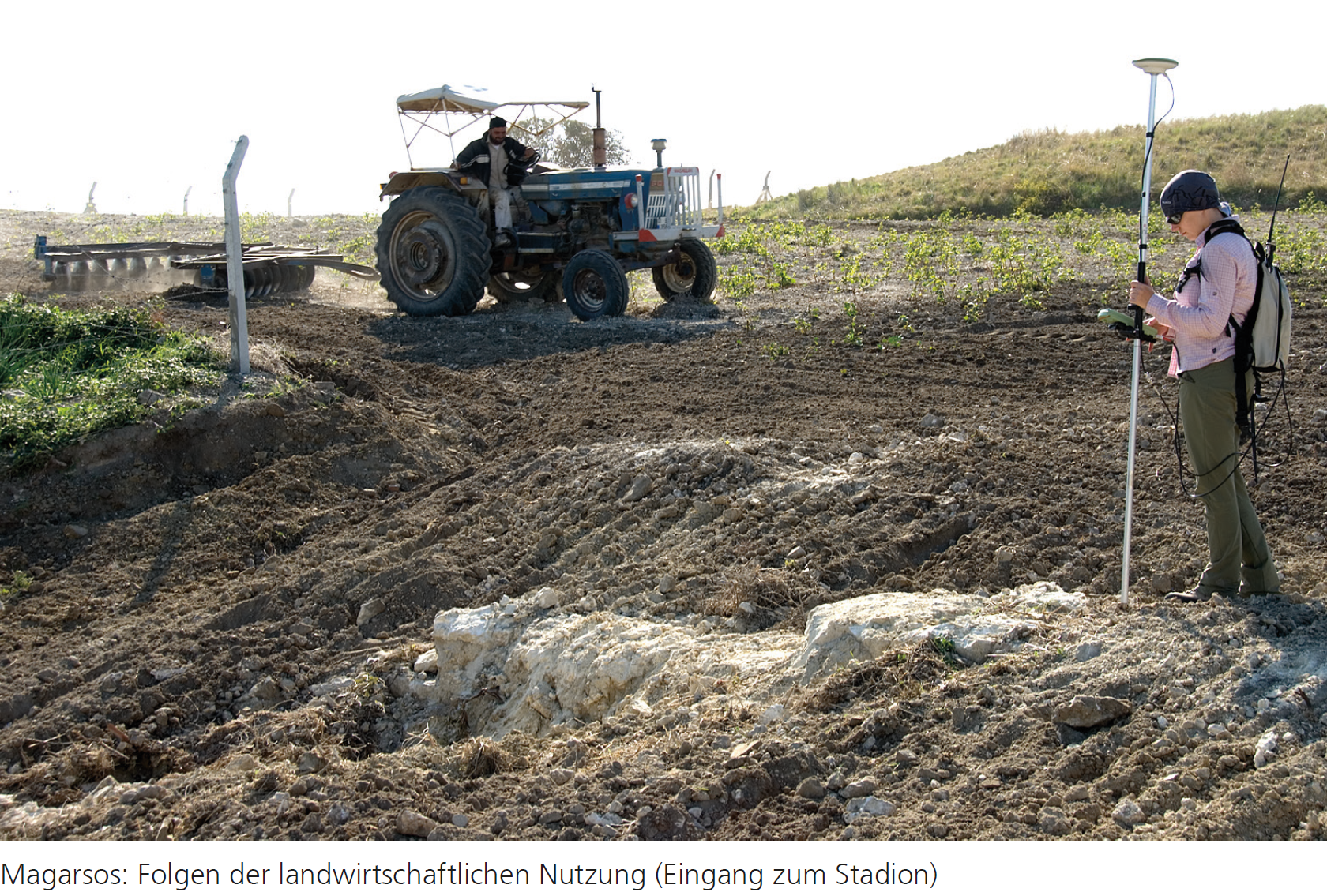
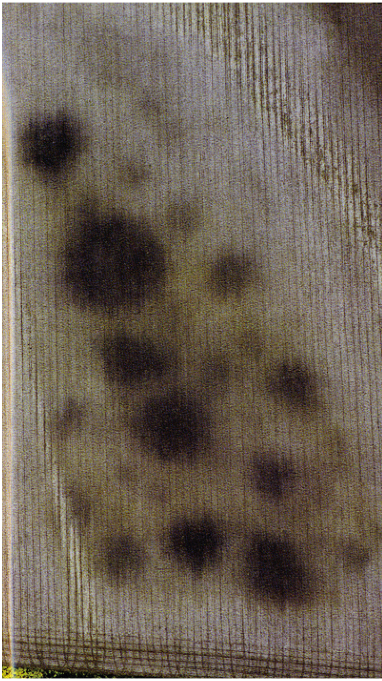
Magarsos: Ausschnitt aus den Ergebnissen der Geomagnetik (Rosenbauer/Sayar)
Ground Truth
Rutishauser 2022

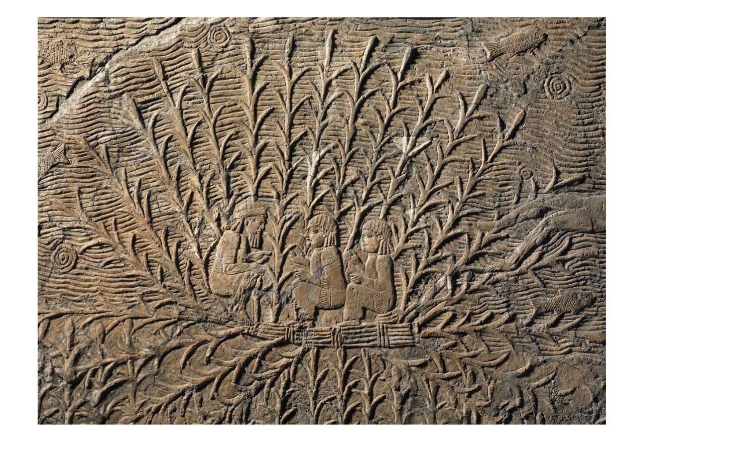
Iconography
https://www.britishmuseum.org/collection/object/W_1851-0902-22-a, © The Trustees of the British Museum, Ninive, SW-Palast
Homework
- Sissakian, V.K. et al. (2020): Geomorphology of the Mesopotamian Plain. A Critical Review, Journal of Earth Sciences and Geotechnical Engineering 10:4, 1–25.
- Rost, S. (2017): Water management in Mesopotamia from the sixth till the first millennium B.C, Wiley Interdisciplinary Reviews: Water 4:5.143–153.
- "Richtlinien und Empfehlungen zum wissenschaftlichen Schreiben und Präsentieren für die Vorderasiatische Archäologie und Altorientalische Philologie sowie für die Prähistorische Archäologie"